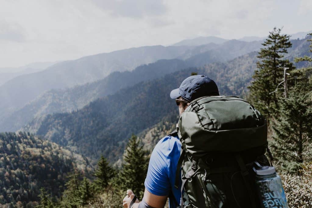
The Appalachian Trail’s highest sustained stretch runs along the spine of the Great Smoky Mountains for roughly 70 miles, staying above 5,000 feet for long stretches and crossing the range’s tallest peaks. It is one of the great ridge walks in eastern North America.
Whether you commit to a multi-day traverse or sample it in day sections from a valley base, this is a route that rewards every approach.
The Route Along the Crest
The AT enters the Smokies from the southwest at Fontana Dam, climbs to the ridgeline, and follows the Tennessee-North Carolina border northeast to Davenport Gap. Along the way, it crosses Kuwohi (the trail’s highest point at 6,643 feet), Silers Bald, and the dramatic rock outcrop at Charlies Bunion.
East of the Rockies, there is nothing else that stays this high for this long. The ridgeline passes through spruce-fir forests that feel more like southern Canada than the American South, tunnels of rhododendron that close in tightly during summer, and grassy balds that open onto views stretching across both states.
This is the roof of the southern Appalachians, and it feels like it.
Section Hiking It in Day Trips
You do not need a week off work or a fully loaded pack to experience this ridge. Several road crossings break the 70-mile stretch into day-sized pieces.
Best Day Sections for Strong Hikers
Two sections stand out for hikers who want the best of the ridge without an overnight commitment.
Newfound Gap to Charlies Bunion
The most popular day hike on this stretch starts at Newfound Gap and heads east, covering about 8 miles round trip. The trail rolls along the ridge with steady views the entire way.
The Bunion itself is a rock face that drops away sharply into the valley below. It is the kind of payoff that earns its effort.
Kuwohi to Silers Bald
For hikers who want higher elevation, the walk from Kuwohi southwest toward Silers Bald stays above 6,000 feet for most of the route. The forests up here are dense and quiet.
On clear mornings, you can see ridgelines stacking into the distance from every gap in the canopy.
Both sections are strenuous enough to feel like real mountain hiking but manageable within a single day if you start early.
Access Points and Logistics
Getting to the trailheads is straightforward, but point-to-point hikes take a little more planning.
Newfound Gap
This is the easiest starting point. It sits right on US-441 with a large parking area and puts you on the AT in seconds.
Kuwohi Road
This spur road provides access to Kuwohi during its open season, typically April through November.
Shuttle Options
Point-to-point day hikes require either two vehicles or a shuttle service. A few local outfitters run hiker shuttles, but availability varies by season, so it is worth confirming in advance.
The Multi-Day Traverse
The full 70-mile ridge walk takes most hikers five to seven days. Planning it comes down to two things: shelter reservations and weather windows.
Permits and the Shelter System
Overnight stays in the Smokies backcountry require a permit from the National Park Service. The AT corridor has shelters spaced roughly a day’s hike apart, and section hikers must reserve specific shelters for specific nights.
Thru-hikers walking the full 2,190-mile AT follow a different permit process. Section hikers booking only the Smokies stretch need to plan shelter stops in advance.
One park-specific rule catches people off guard: you cannot pitch a tent at a shelter site unless every bunk is full. Understanding your shelter options before you go removes a lot of guesswork from the planning stage.
Seasons and Weather at Elevation
Late spring and early fall are the best windows. May and June bring wildflower blooms to the balds and long daylight hours on the ridge.
September and October deliver cooler temperatures and stretches of visibility that summer rarely offers.
Summer is hikeable, but it comes with afternoon thunderstorms that roll in quickly and drop temperatures sharply. Winter is possible for experienced hikers, but ice, short days, and temperatures well below freezing at 6,000 feet make it a serious undertaking.
No matter when you go, rain gear is non-negotiable. The Smokies receive upward of 85 inches of precipitation annually at higher elevations.
Using a Valley Cabin as Basecamp
Not everyone wants to carry a full pack along the ridge, and not everyone needs to. Section hikers can break this 70-mile stretch into day hikes by basing out of the valley below.
Pigeon Forge is about 30 minutes from Newfound Gap, making morning trailhead access easy. A cabin gives you a full kitchen to prep trail food, laundry between hiking days, and a real shower after a long day on the ridge.
Groups of four to six hikers who want to rent cabins in Pigeon Forge split the cost while gaining space to dry gear and repack. This basecamp approach lets you carry a lighter daypack instead of a full multi-day load, and that trade changes the experience entirely.
What to Carry on the Ridge
The Smokies ridgeline is not the place to pack light and hope for the best. A few essentials make the difference between a great day on the trail and a miserable one.
Layers and Rain Gear
A waterproof shell and layering pieces handle the temperature swings between sun-exposed balds and shaded spruce forests. Conditions can shift from warm sunshine to cold wind-driven rain within the same hour up here.
Water
Sources on the ridge can be spaced out, so carrying at least two liters is a safe baseline for longer sections. On the hotter summer days, you will want more.
Food Storage
Bear canisters are not required here. The park uses cable suspension systems at shelters for food storage, but you should still pack food to keep odors contained.
Footwear
A pair of solid three-season boots with good ankle support handles the rocky, root-laced trail surface far better than lightweight trail runners on this terrain.
Before You Go
The Appalachian Trail Conservancy maintains a helpful overview of permits and regulations for each state the trail passes through. It is worth reviewing before you finalize your itinerary.
A Ridge Worth the Effort
The Smokies AT section is not the most remote stretch of the trail, but the sustained elevation and the density of high peaks packed into 70 miles make it one of the most rewarding. You can stand on Kuwohi and see the route stretching away along the ridge in both directions.
That single view makes a strong case for why this is some of the best hiking in the eastern United States, whether you day-hike a single section from Newfound Gap or string together a full week along the crest.

About Peter C.
Peter is a digital nomad who largely writes from Asia, Europe, and South America. Always following the "vibe," he sets up shop in hostels and AirBNB's and continues to entertain us with wild stories from life abroad. Ask him anything in our community forum. Make sure to download the AllWorld Travel Hacks FREE ebook.